| Day | Route | Mileage | Approx time |
| 1 | Milngavie to Drymen | 12.5 | 6 hours |
| 2 | Drymen to Rowardennan | 15.5 | 7 hours |
| 3 | Rowardennan to Inverarnan | 14 | 8 hours |
| 4 | Inverarnan to Tyndrum | 12 | 6 hours |
| 5 | Tyndrum to Kingshouse | 19 | 9 hours |
| 6 | Kingshouse to Kinlochleven | 9 | 4.5 hours |
| 7 | Kinlochleven to Fort William | 15 | 7 hours |
My friend, Helen, asked me if I would like to walk the West Highland Way. The answer was an immediate ‘yes’. I had already planned it out as I knew it was a trail I would do sometime soon. I couldn’t decide whether to do it alone or with friends. Helen’s invitation made my mind up and within a week we had everything booked.
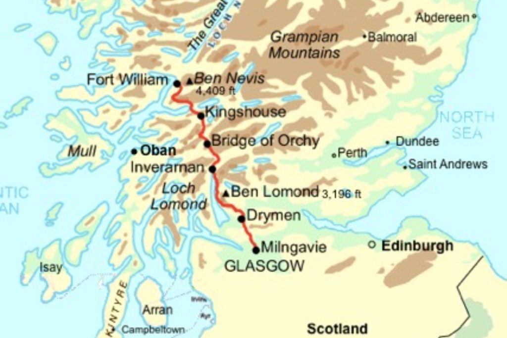
The WHW was the first official long distance footpath in Scotland and is mostly on well maintained paths. We completed the path in 7 days and in that time walked through some of the most spectacular scenery in Britain.
The first part meanders around the shores of Loch Lomond before entering the rugged mountains of the Highlands. We walked on ancient tracks used by soldiers (the Military Road) and drovers (the Drovers Way), old rail and coaching routes, through ancient forests, across remote moors (Rannoch Moor) and up steep climbs (Devil’s Staircase). We took in breathtaking mountain views, with Ben Nevis (sadly in cloud) rising above the conifers on the last day.
This is the route from Milngavie, a pleasant town just north of Glasgow, to Fort William, the centre for hillwalking and climbing in the Highlands.
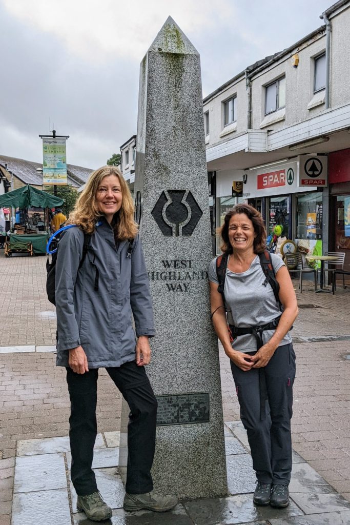
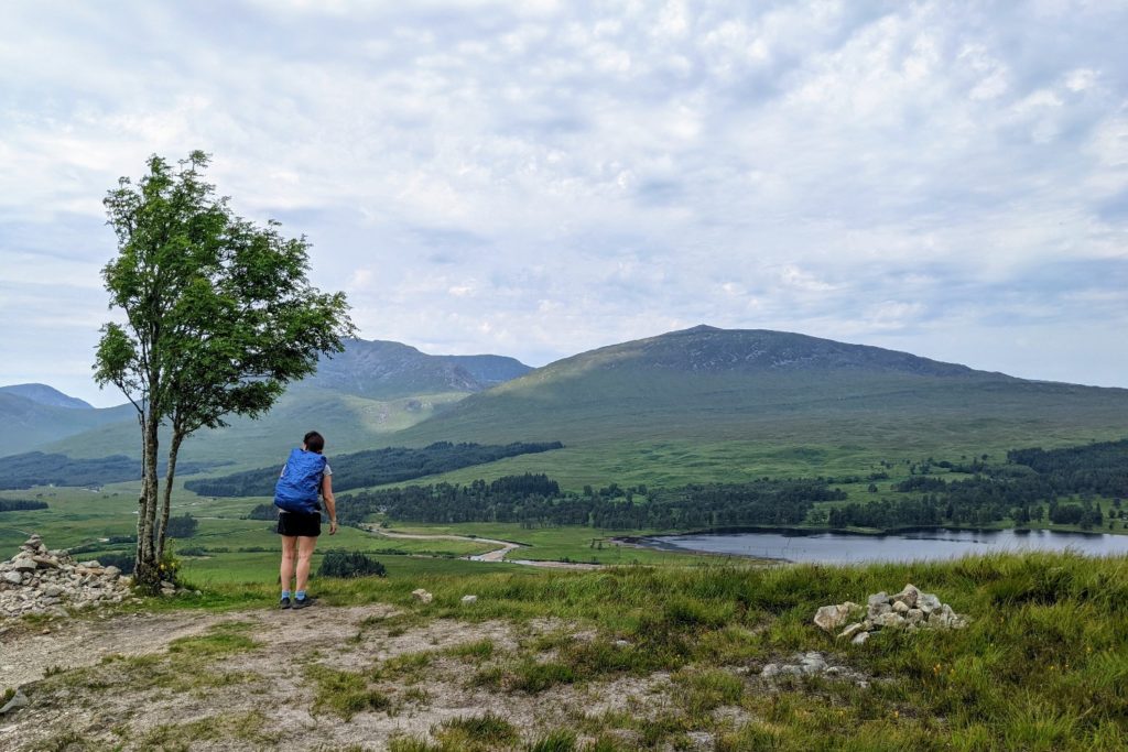
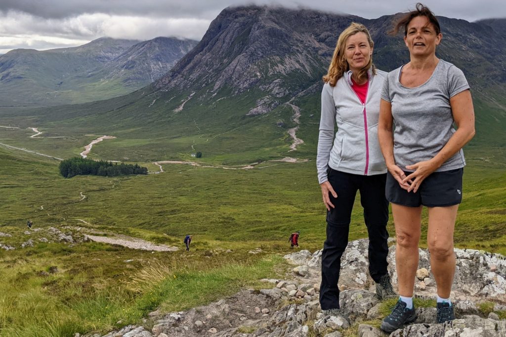
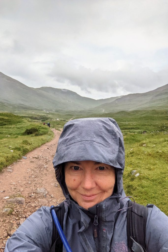
We started the WHW in the centre of Milngavie at the obelisk, in a slight drizzle. As you can see from the photo, I overdress and Helen underdresses – a theme which would continue throughout the walk!
Fairly gentle paths took us through Milngavie’s suburbs in parks and woodland. Once out into the countryside we were bathed in bright sunlight and passed Craigallian Loch with views of the Campsie Fells in the distance. We wandered through the interesting hamlet of Carbeth, a community of huts which was established in 1918 after the first world war as a summer camp for returned soldiers.
Glimpses of the Highlands far in the distance revealed themselves as we walked across open grassland. The Glengoyne Distillery was a short hop from the path, but we resisted the temptation to detour to sample the whisky.
We stopped for lunch at a pub which was right on the path, called the Beech Tree Inn, close to Dumgoyne hamlet. An eccentric place with a cafe, bar, large beer garden, small shop, play areas and lots of animals. The owners were very welcoming and it is a great place to stop off and stock up on food and drink.
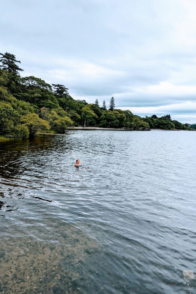
Continuing on the flat track we joined a minor road. As we walked through the pretty hamlet of Gartness, we saw a lovely path down to the river, Endrick Water. A local woman was swimming in the river and Helen joined her, whilst I paddled. It was a beautifully calm and peaceful spot to cool off after a hot day.
We walked the remaining few miles along a quiet country lane into Drymen.
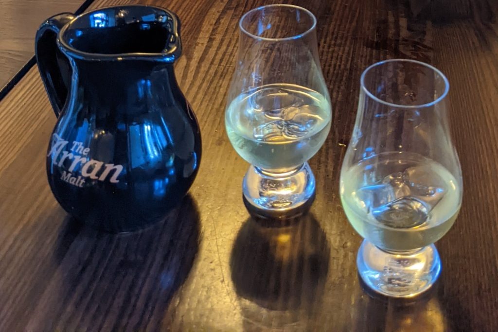
In the evening we had a hearty meal at the Clachan Inn, which claims to be Scotland’s oldest licensed pub, established in 1734. A really good evening where we sampled some whiskies. We tried two local whiskies from the Glengoyne Distillery. One was a citrus tangy one, the other had toffee, vanilla and hints of shortbread. Allegedly! We tried to like them, but we didn’t. We really don’t like whisky.
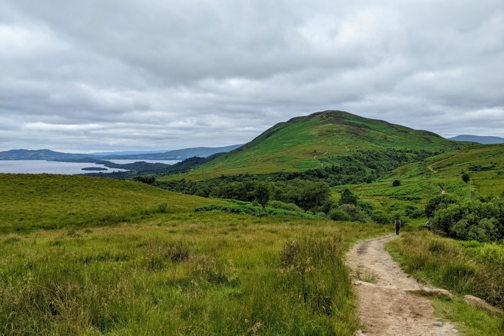
The first part of today’s walk climbed gently through a forest on a wide track, with bridge crossings over some pretty streams. The day was cloudy and breezeless. Trees stood tall and eerily still.
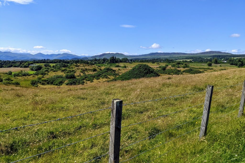
We then followed a spectacular high route through more forest and out onto open moorland to ascend the 360m Conic Hill.
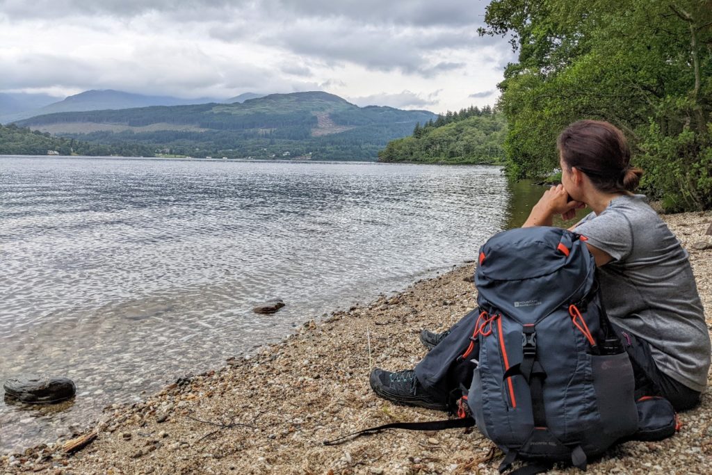
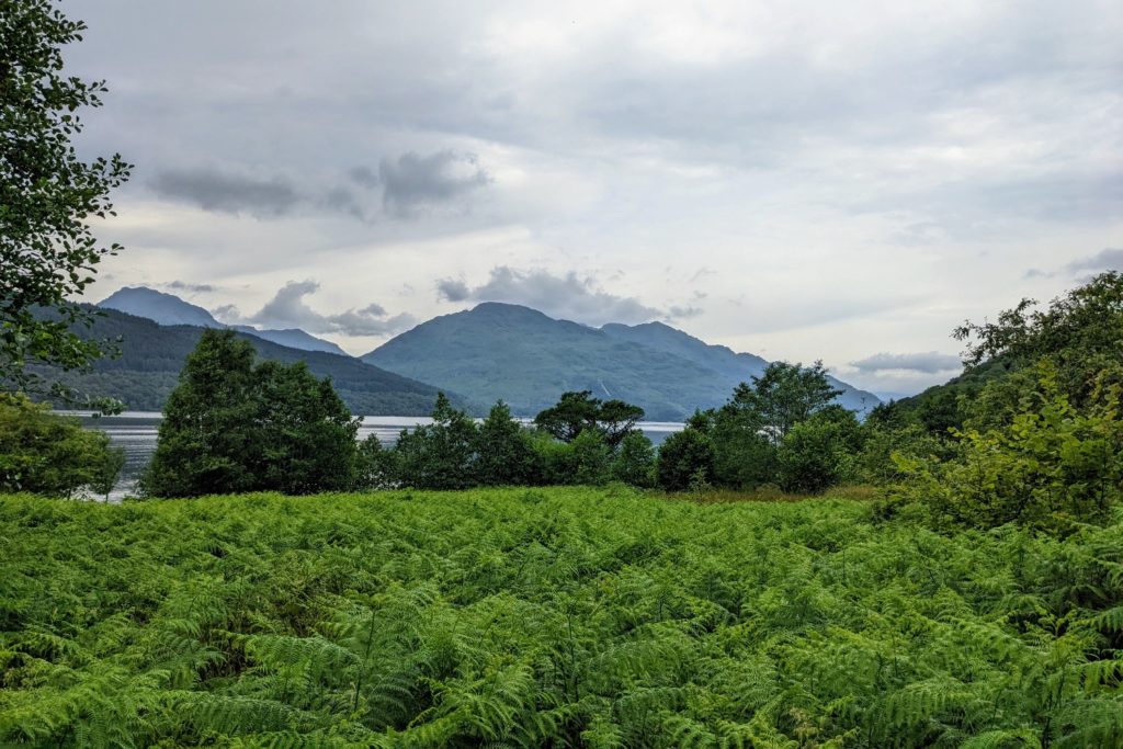
From here there was an incredible view over Loch Lomond and the surrounding countryside, with the line of islands visible across the loch. Loch Lomond is the largest area of fresh water in Britain. 23 miles long and up to 5 miles wide and 190m deep at its deepest point.
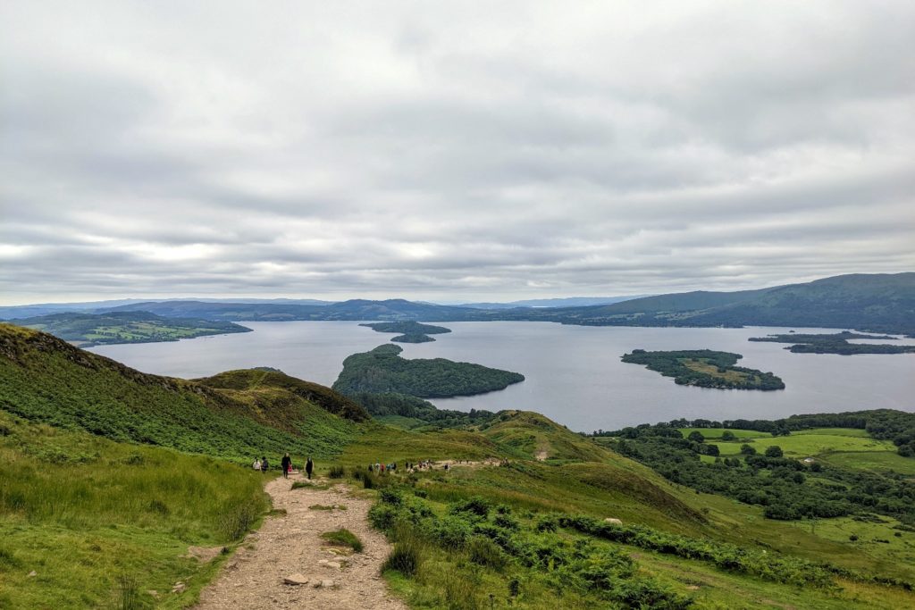
The descent was long and rapid and emerged into the hamlet of Balmaha on the banks of the loch.
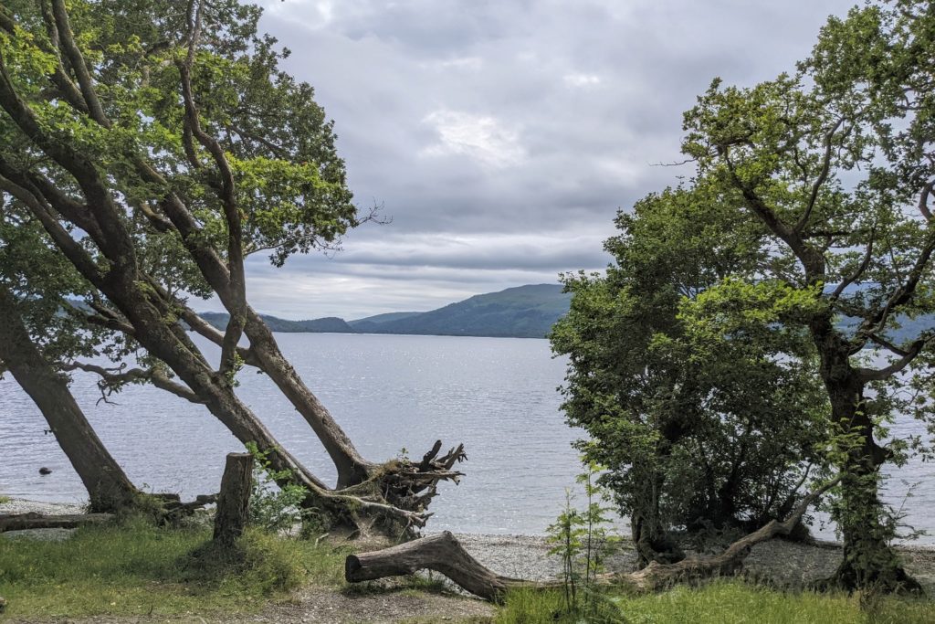
The second part of the day was walking along the ‘bonnie banks’ of Loch Lomond. The path stayed close to the loch, sometimes at the water’s edge, at others climbing into the forests high above the water. It meandered through woodland, past rocky coves, into small beaches, with the occasional stretch along the road. There was a beautiful variety of terrain and scenery.
The spectacularly located Rowardennan Youth Hostel was our destination after a hot and tiring day. The hostel is a beautiful Victorian hunting lodge with picture windows overlooking the loch and the surrounding mountains.
We enjoyed a cool, refreshing and soothing dip in the water, followed by a glass of wine facing the loch. We couldn’t have asked for a more wonderful setting.
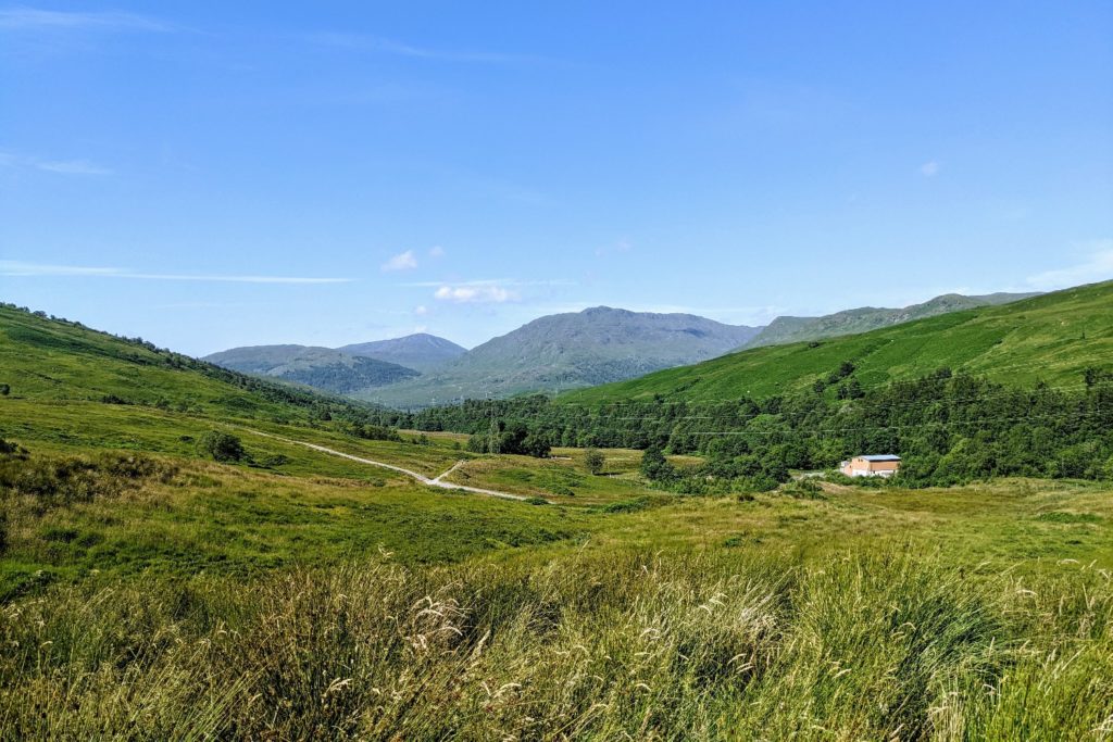
After today’s 15 miles we were only halfway along the loch. The scenery was starting to become more remote and exposed. Conic Hill and surroundings were a taste of what was to come.
Today was a tough day. We followed a narrow, rough path, close to the loch shore. There were numerous short steep climbs, fallen trees to negotiate and uneven rocky sections. Some of this was tricky underfoot and required concentration. Narrow ledges, wet rocks and tangled tree roots were constantly threatening to make us trip or slip.
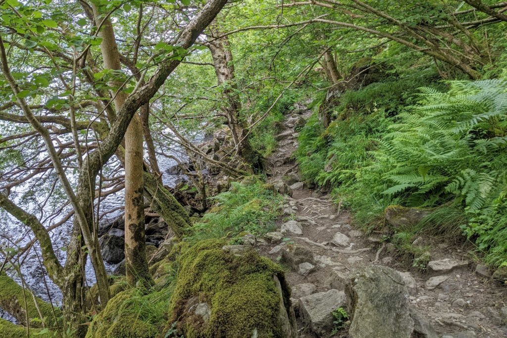
The hot and humid conditions added to the difficulties. There was the odd respite as we landed on a tranquil and deserted beach, but progress along this stretch was slow and arduous.
After the rough track in the trees, we came to a much wider and flatter path, slightly undulating, but much easier. This wide path was short-lived. Quickly, we were back on to craggy, bumpy ground. In amongst the hard work there were some incredibly picturesque views.
We arrived at Inversnaid at lunch time where we viewed the spectacular waterfall. The hotel had lots of lovely snacks, cakes and drinks at incredibly reasonable prices with outside seating overlooking the loch.
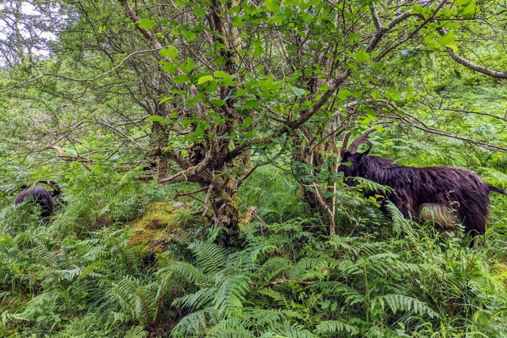
The next 3 miles after Inversnaid were again on rocky ground winding through the woods. We negotiated more steep craggy slopes and difficult terrain. We came across several tame wild goats chomping on the leaves and bashing their horns on the branches.
For the last 3 miles we left the loch behind and headed uphill to find ourselves in grassy and bracken covered hills with magnificent mountains all around us. This was my favourite bit of the day. Finally we could walk without thinking about where we placed every step.
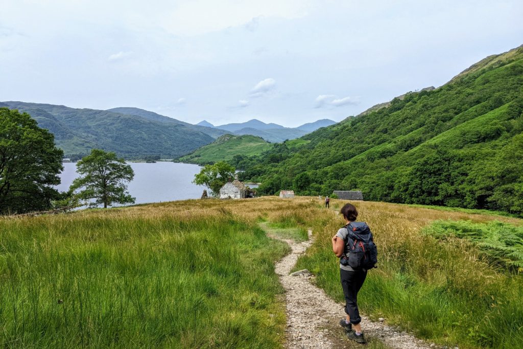
We could see views towards the rocky fells and mountains as we arrived at our accommodation at Beinglas Farm Campsite just outside Inverarnan. Here we encountered a wonderful community of WHW hikers.
The next section of the path started directly from the Beinglas camp site. There was a very gentle gradient through fields, which opened up into beautiful sheep pasture, with mountain scenery all around. We followed some narrow tracks, overgrown with shrubs and then a wider track, which was a section of the old 18th century military road.
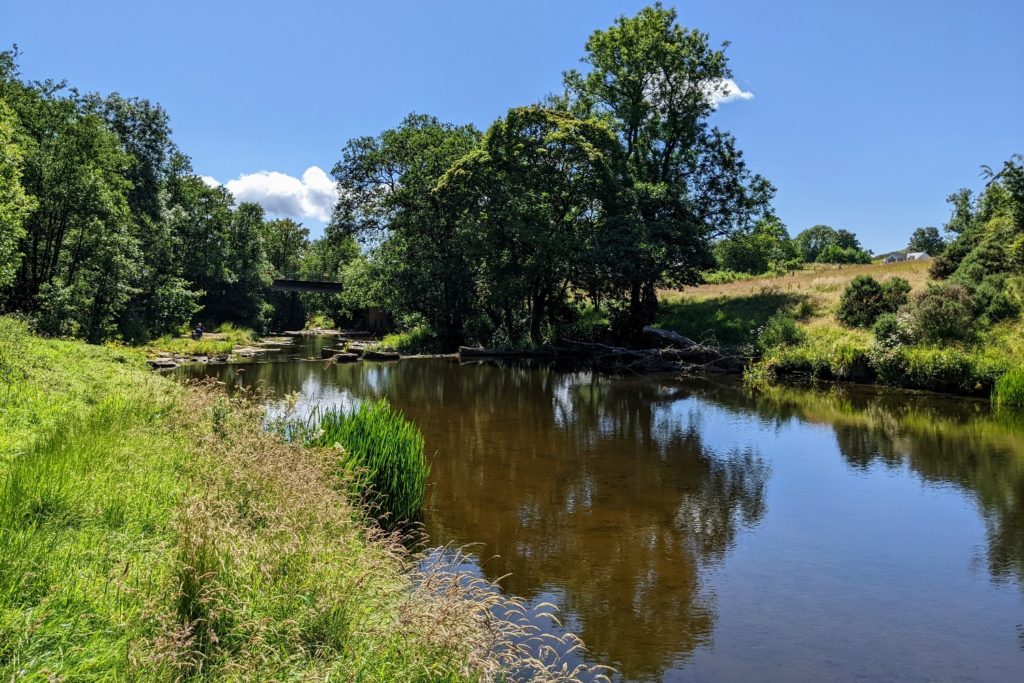
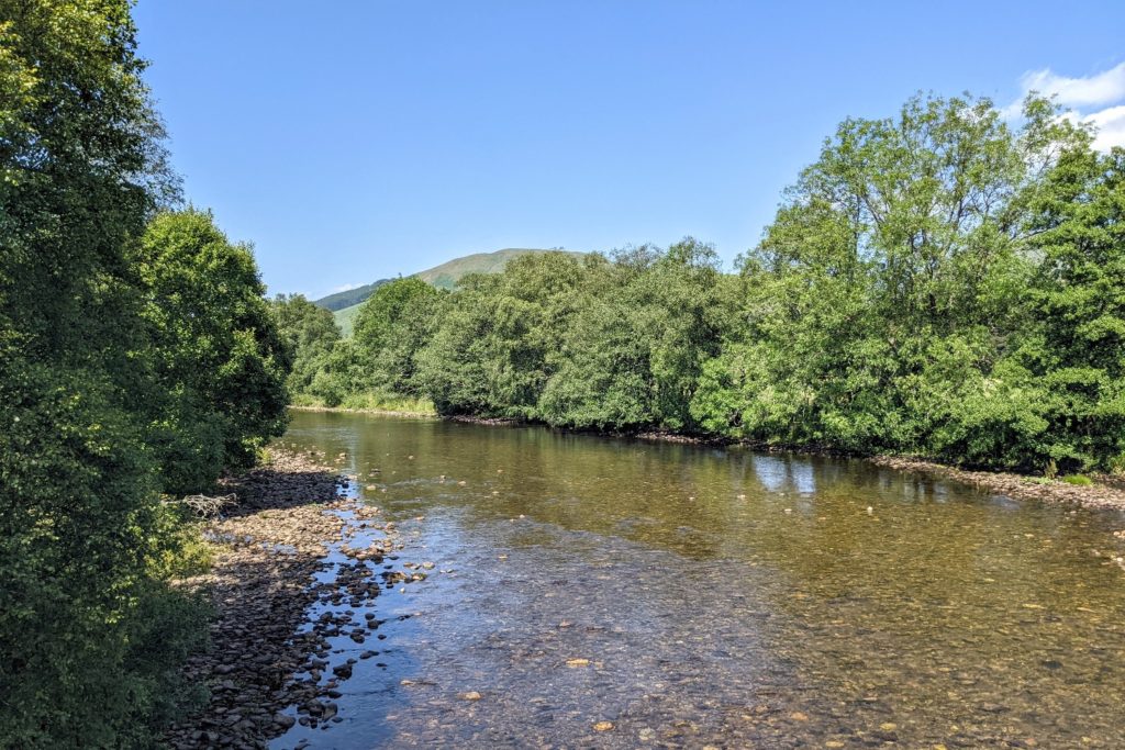
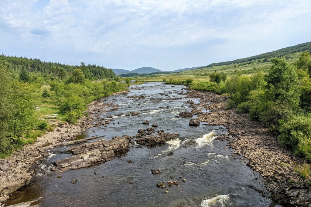
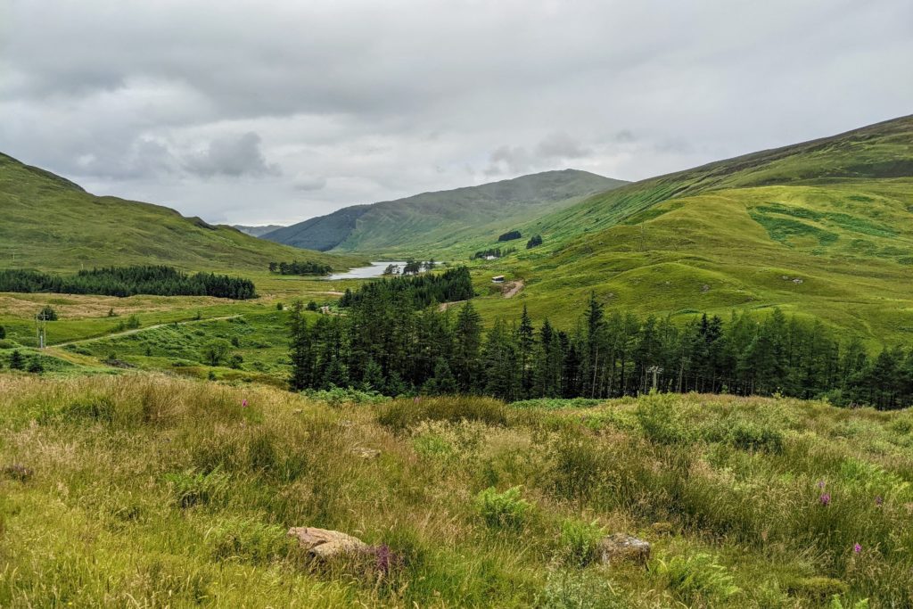
The route passed through Glen Falloch, close to the beautiful Falloch river and the Highland Line railway track, where occasional trains rattled past.
At the halfway point of the WHW there was the option to go to the village of Crianlarich, but as it was a 15 minute detour we decided to push on. The path turned left and climbed for a long way up into the beautiful conifer forest where we were able to cool down a little after the searing heat. We had been under the glare of the full sun in the open spaces.
There had been a number or hikers on the first stretch, but once we entered the forest and Helen’s faster pace left me behind, I found myself alone. It felt good to wander at my own pace in the stillness and shade of the enormous conifers. Some space and time for myself to take in the surroundings. Through the trees many of the Highland peaks were revealing themselves, lit up in the bright sunshine.
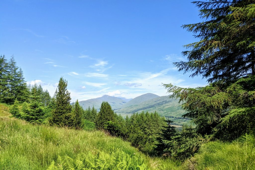
The path descended to the flat valley bottom and came out into farmland. It then followed the river, passed across some moorland, and along the river again into the small village of Tyndrum.
Today was the first day of the heat wave and it was tough going at times. Luckily it was a short day and we arrived at our hostel mid afternoon. We had the hostel almost to ourselves; there was only one other person staying there. Many of our fellow hikers were camping outside, in the grounds of the hostel.
A 19 mile day was always going to be a challenge, but when we heard the weather forecast predicting temperatures up to 40 degrees in parts of the UK we realised this could be even harder than we thought. The temperature in Scotland was a mere 26 degrees but this was still very hot for long distance hiking.
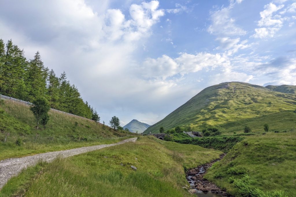
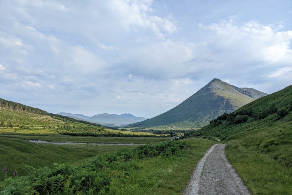
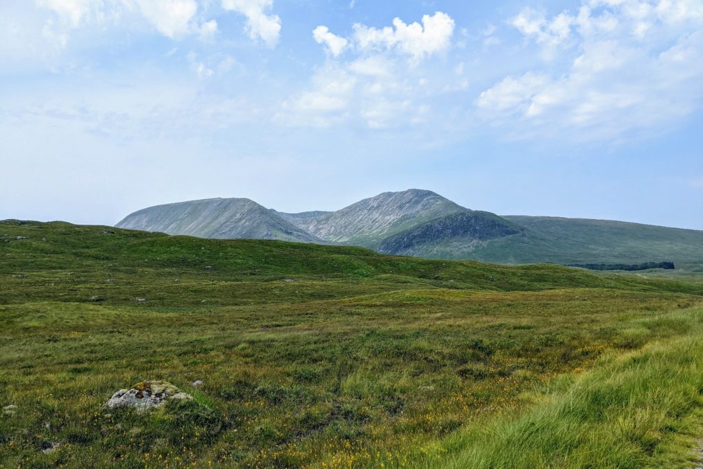
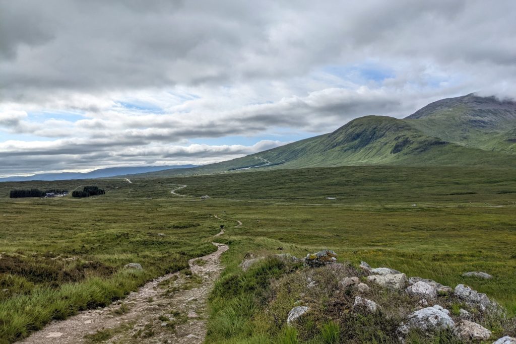
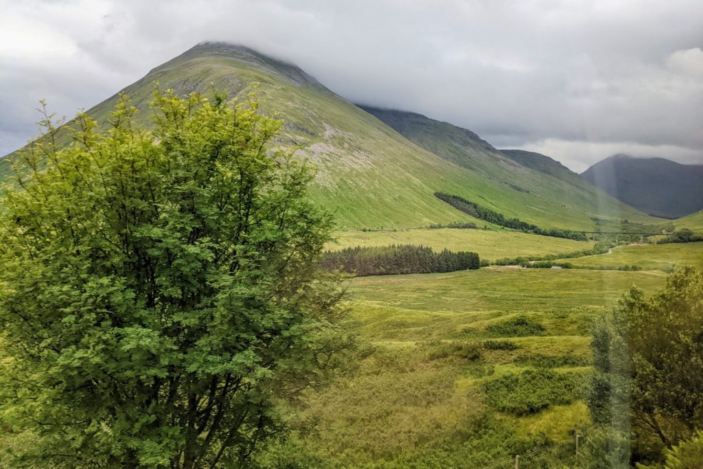
We started early, setting off shortly after 7am. We knew we would only get a couple of hours before the real heat of the day hit us. Out of Tyndrum we were straight back onto the old military road. This meant good, mostly level walking on the worn cobbled surface, so we could cover the miles quickly. This road continued for miles and became a little tedious. The monotony was alleviated by the wonderful mountain scenery. Green pastures, flowing rivers, waterfalls, grazing sheep and high peaks were delightful distractions. The route gave some marvellous views – first of Beinn Odhar and then Beinn Dorain, with its almost perfect conical shape.
After seven miles, we stopped for coffee at the Bridge of Orchy Hotel.
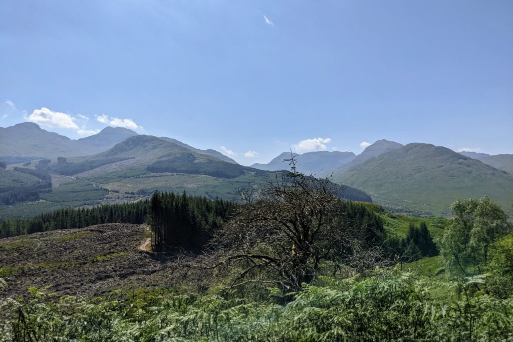
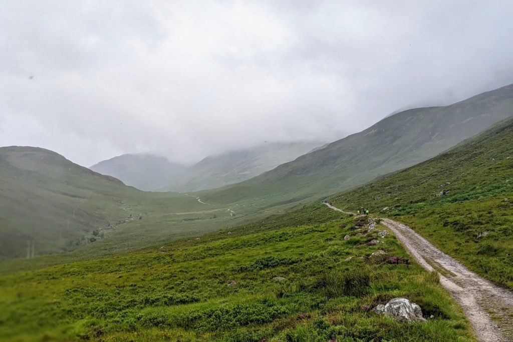
The next part of the walk, in the heat of the day, became more challenging. For around 3 miles the path rose gently through the trees and then out into open mountainside reaching 320m with excellent views over Loch Tulla, Rannoch Moor and the Black Mount.
This landscape was the most remote and wild that we had experienced so far.
The path descended down to the Inveroran Hotel, followed a road for a short while and then joined the old cobbled drover road, built by Thomas Telford in the early 19th century. This was hard terrain, hard conditions and hard going, but there was some shade in the trees to stop and refuel. It slowly ascended on to Black Mount, which is high moorland, from where views of some of the higher munros were visible. In spite of the spectacular scenery, we were struggling in the sweltering temperatures and this road felt like it went on for ever.
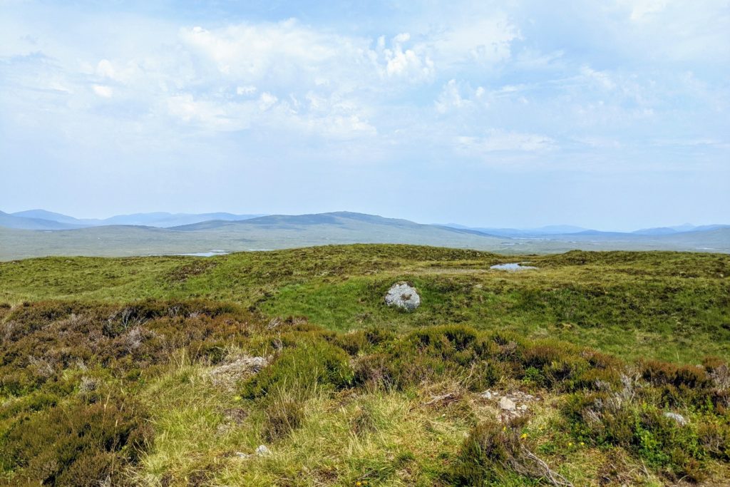
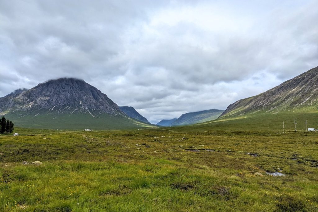
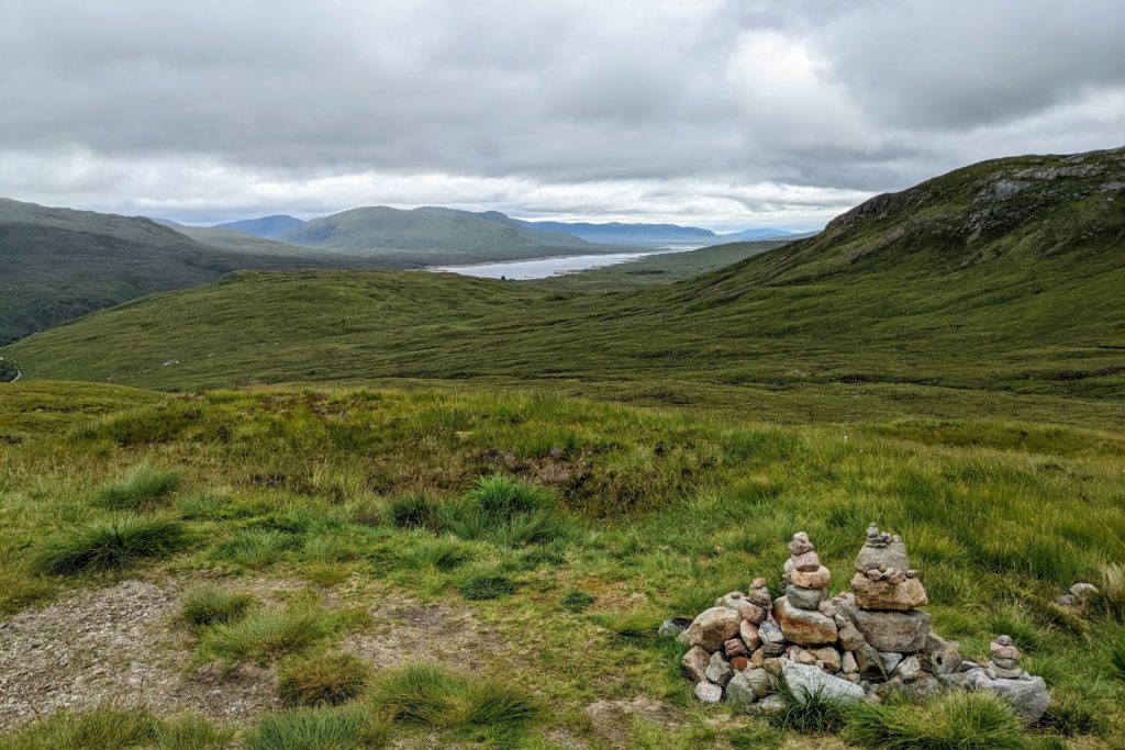
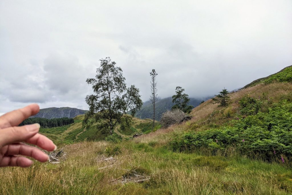
We finally came to more desolate landscape and the remotest and wildest section of the whole WHW. The expanse of Rannoch Moor, the largest uninhabited wilderness in Britain, stretched as far as we could see. The large mountain range, including the 1109m Meall a’ Bhuiridh, towered above us. The guidebook said “there are no escape routes, nor is there much shelter, for the next 10 miles, so come prepared as the weather here is notoriously cruel”. In our case it was cruel in its heat.
The undulating path tested our fitness, spirit and endurance as the temperature rose to over 26 degrees. There was no shade and no escape from the sun. Walking was slow, but the views were remarkable on such a clear day.
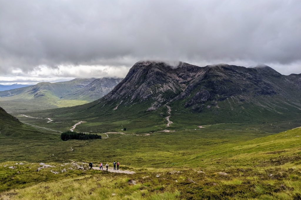
The highest point of the day was 445m after which we descended and diverted to the Glen Coe ski centre, where I arrived desperate for water. I had run out of water at mile 15 so was in need of hydrating.
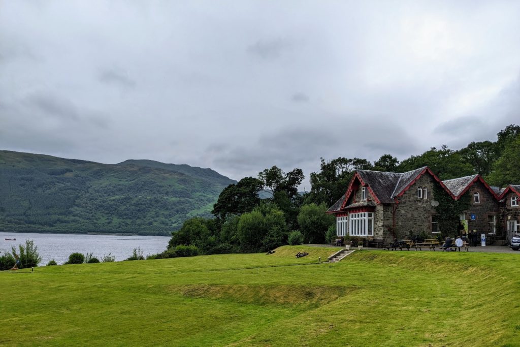
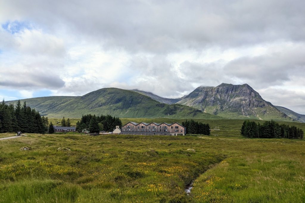
After a long stop we descended to Kinghouse, a remote and delightful stop. It is just a hotel, bunk house and camp site which enjoys the stunning views of Glen Coe. Shortly after arriving at Kingshouse the weather suddenly changed to wind and rain which we didn’t mind at all.
Today gave us a great sense of achievement: a long distance, some incredible scenery and we survived it in the heat.
After yesterday’s (near) marathon in the heat, today was a different story. It was a short hop of 9 miles and the cooler conditions were perfect for walking. We passed through some more inspiring mountainous terrain.
The day started with a stretch of path parallel to the busy A82 road. This was an easy, fairly flat start. We were dwarfed by the magnificence of the steep sided mountains around us in all directions.
We soon turned off upwards to climb the Devil’s Staircase which took us to the highest point of the WHW. The ascent reached 530m, a sustained climb, but not devilish as the name implies. It is thought that the name originates from the soldiers who had to climb this twisting military road up the inhospitable hillside in the 1750s.
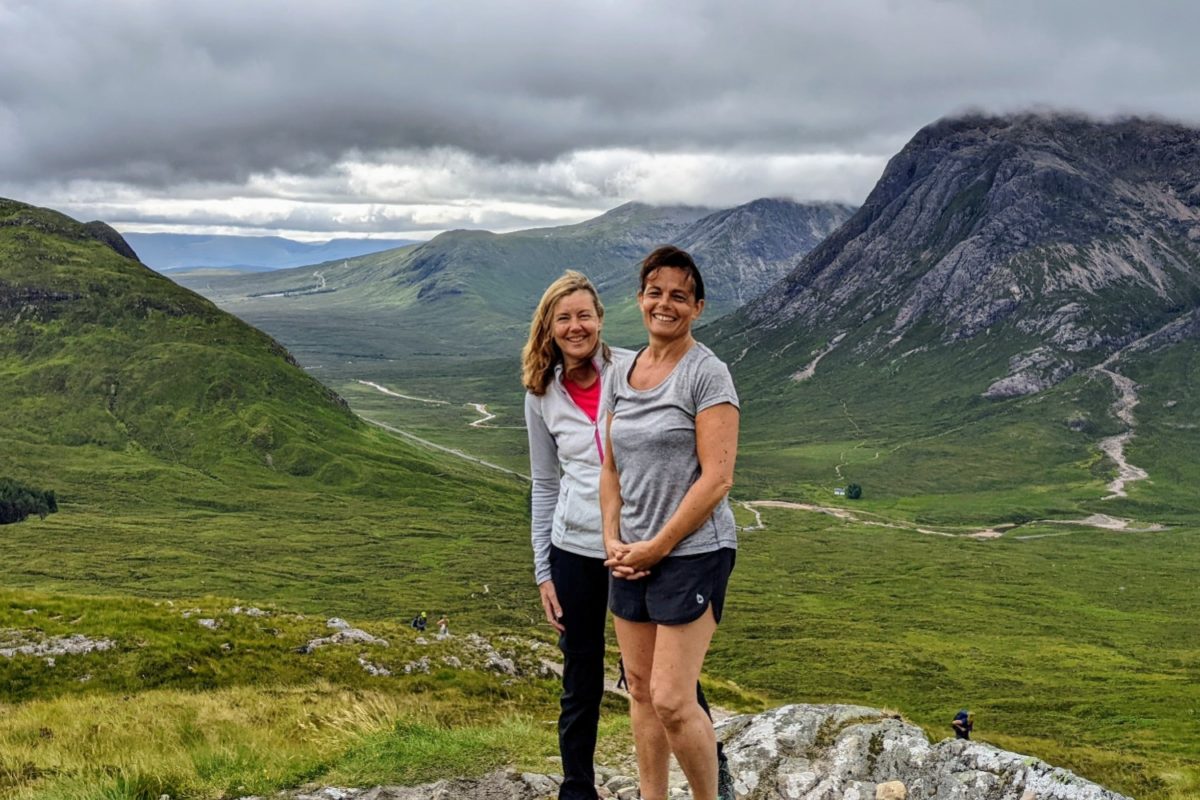
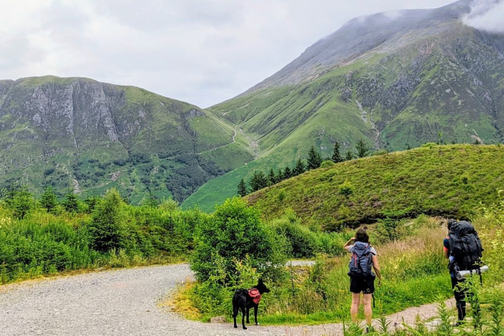
The reward at the top of the climb was views over the Glen Coe peaks and north to Ben Nevis. We could see miles of wilderness, steep mountainsides, heather and bog. It was a marvellous day for views, although the top of Ben Nevis was obscured by cloud.
From the top there was a very long descent across the rugged mountainside. We could see the Blackwater Reservoir, which was created by the Blackwater dam in 1905 to supply water to power the hydro electric plant in Kinlochleven.
The last part of the walk was on a long steep uninspiring four-wheel drive track passing the pipes and buildings associated with the water supply. This path seemed to go on forever. More industrial buildings lined the route into Kinlochleven, but the centre of the village, especially by the river was much more pleasant. It is nestled deep in the valley, with a fast flowing river, surrounded by magnificent mountains.
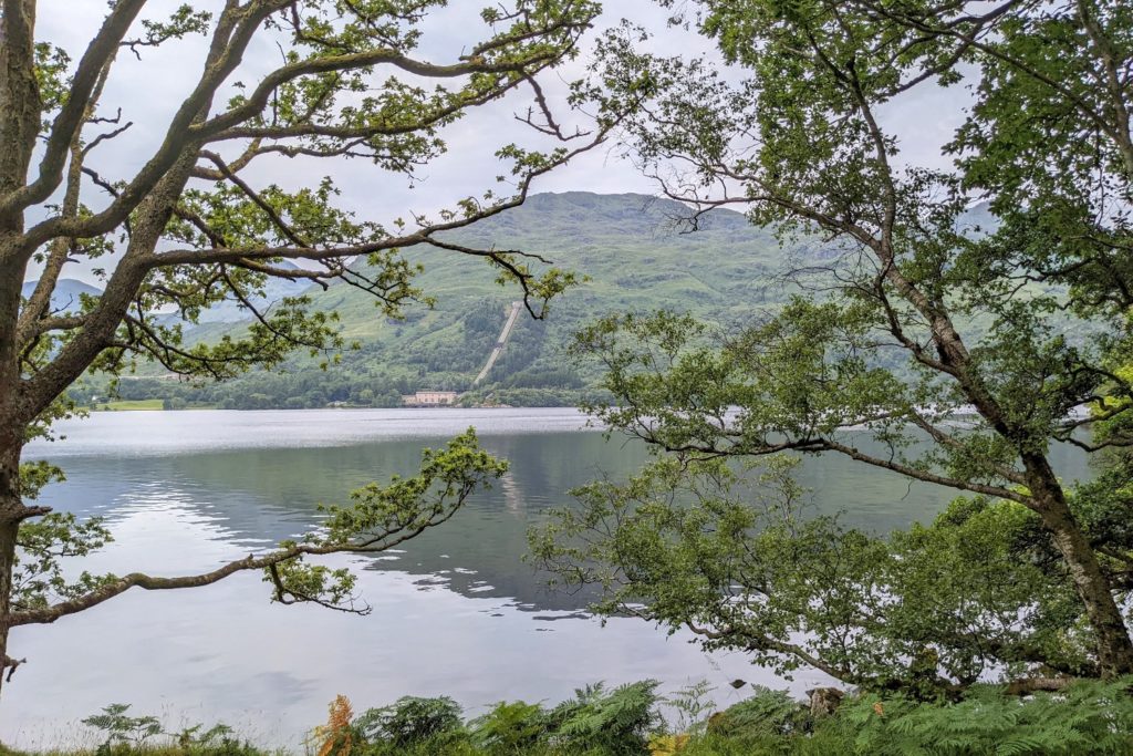
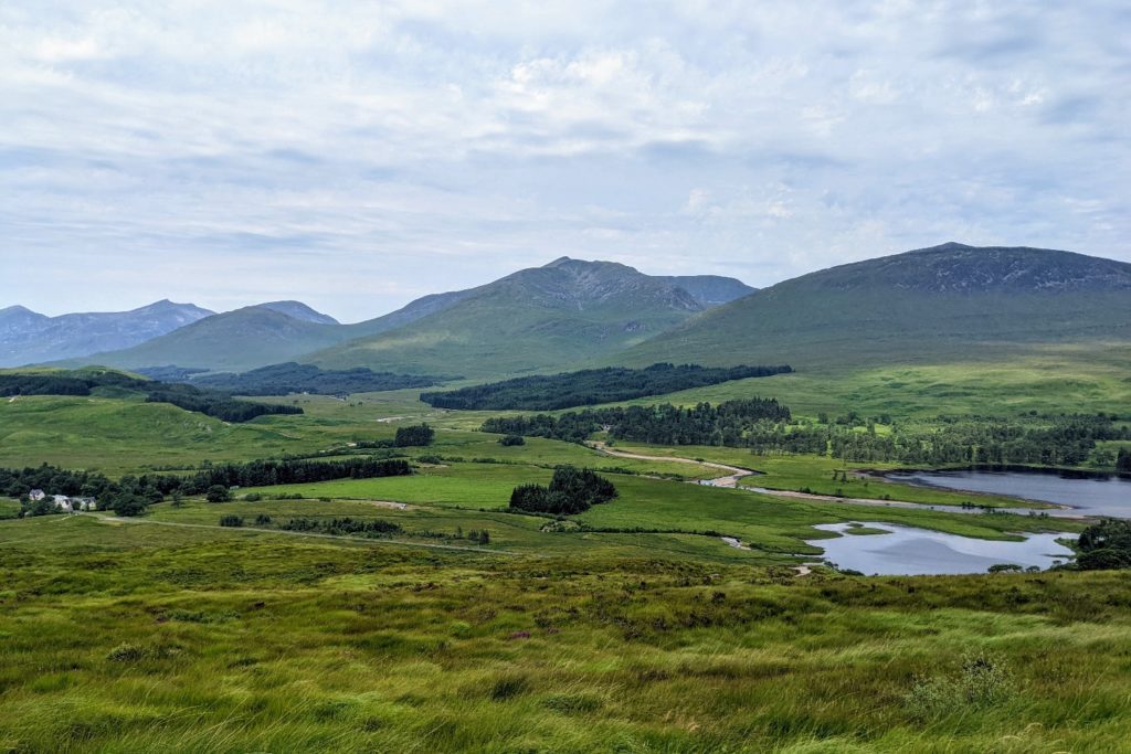
We had a lovely evening in the Highland Getaway Inn, drinking on the upstairs bar terrace, from where the amazing view above was taken.
I had carried my rain jacket for 90+ miles unworn. On the final day I actually wore it. It felt more like Scotland to be walking in drizzle, surrounded by cloud covered mountain tops and a cooler, more comfortable temperature. On a day which was both tough and rewarding, we felt small in the remote and exposed glens, surrounded by imposing mountains.
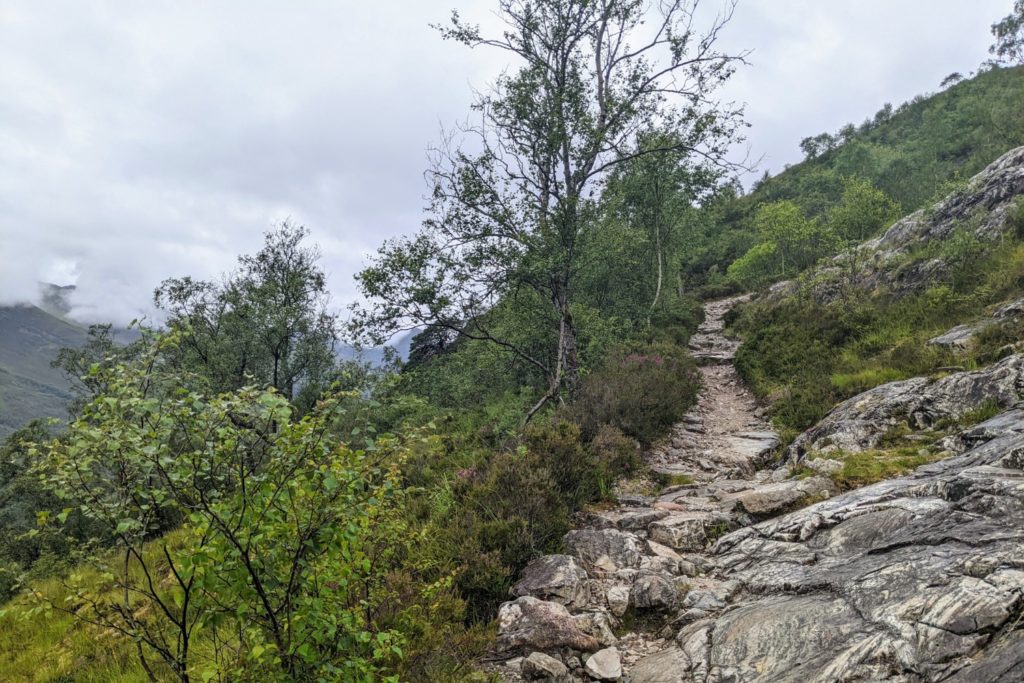
After leaving the pretty village of Kinlochleven, there was a long sustained climb on a steep winding trail through birch trees, at times rocky under foot.
At the top, the walk continued onto a wide, windy track, the old military road. This long, meandering path traversed the mountain side with glorious views over Loch Leven to the grand mountains of Glencoe.
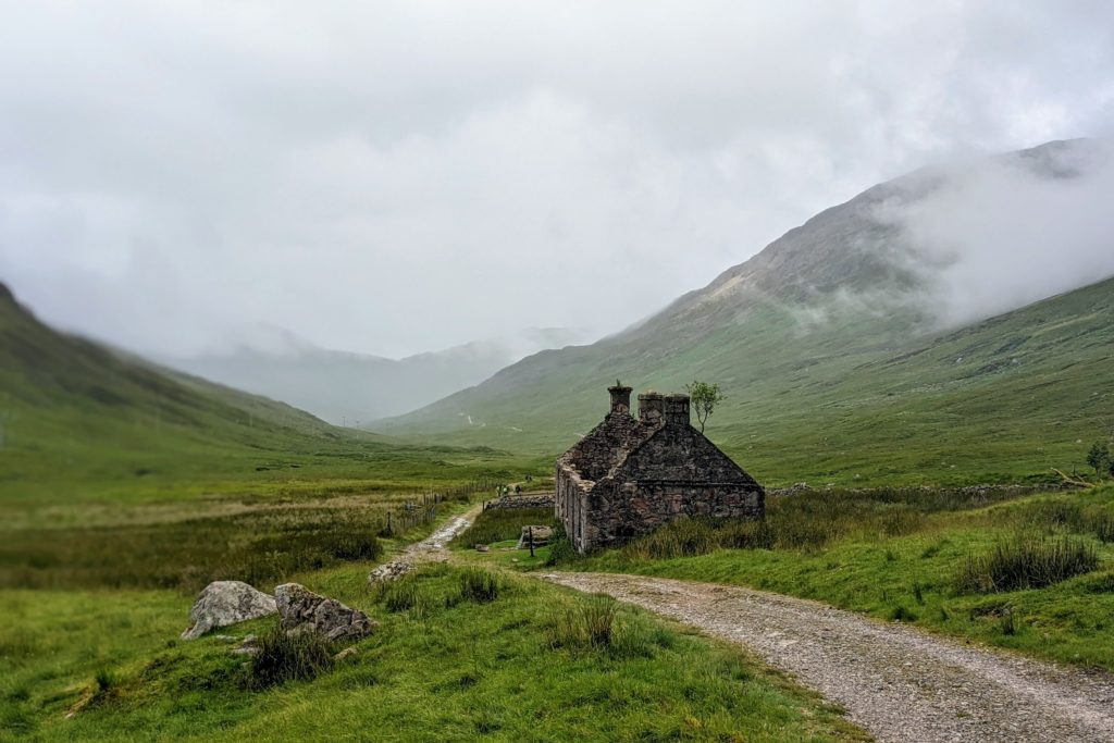
The trail rose gently through a wide valley passing ruined cottages and little streams, and arrived at the Lairigmor pass at 330m.
After several glorious undulating miles through the glen, the path entered forestry tracks. At this point the weather was clearer and the atmosphere humid once again.

We continued, with glimpses of high, steep mountains before Ben Nevis came into view. The top was in cloud but we were able to visualise its magnificence from our view of the lower slopes.
A final path descending on forest tracks took us into Glen Nevis and then we walked the final 2 miles of the WHW along the road into Fort William.
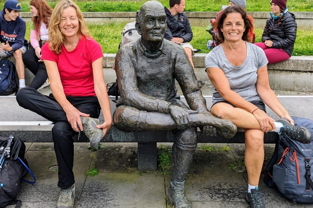
We made it to the Man with Sore Feet statue in Gordon Square at the end of the High Street and had the obligatory photo shoot.
A wonderful week of walking. 97 miles. Exhausting at times, but spectacular. We travelled home with a great sense of achievement and gratitude for experiencing some of the wonders of the Scottish highlands. I would highly recommend this walk.
I will definitely return to certain parts to explore further. In particular I would like to climb some of the mountains around Kingshouse and also alight from the West Highland Line at Rannoch or Corrour and walk into the wilderness.
| Train to Milngavie from London |
| London Euston to Glasgow Central (Avanti West Coast) – around 5 hours |
| Glasgow Central to Glasgow Queen Street (PlusBus) – 5 minutes |
| Or 7 minute walk (0.4 miles) |
| Glasgow Queen Street to Milngavie (ScotRail) – around 30 minutes |
| Train from Fort William to London |
| Fort William to Dalmuir (ScotRail) – 3.5 hours |
| Dalmuir to Glasgow Central (ScotRail) – 30 minutes |
| Glasgow Central to London Euston (Avanti West Coast) – around 5 hours |
I didn’t know about this train journey until I was actually on it. The West Highland Line from Fort William to Glasgow is considered by many to be one of the most scenic rail journeys in the world. The line is a twisting single track through fabulous highland scenery often miles from the nearest road. No roads were ever built here. It goes through a magnificent landscape of mountains, lochs and moors. Some of the stations eg Rannoch Moor and Corrour are extremely remote and consist of just a few buildings and nothing more for miles around. Just near Corrour the line reaches its summit which is 411m above sea level.
It is well worth taking this journey, even if you don’t walk the WHW. What an unexpected and incredible bonus to the trip.
| Milngavie | Premier Inn, 103 Main St, Milngavie, Glasgow G62 6JQ (clean and comfortable, as you would expect from a Premier Inn) |
| Drymen | Kip in the Kirk, 11 Stirling Rd, Drymen, Glasgow G63 0BW (fabulous, fresh scones on arrival, good breakfast) |
| Rowardennan | Rowardennan Youth Hostel, By Drymen, Rowardennan, Glasgow G63 0AR (fantastic location on the loch, good facilities) |
| Inverarnan | Beinglas Farm Campsite, Loch Lomond, Inverarnan, Arrochar G83 7DX (great place with excellent facilities, cabin beds uncomfortable) |
| Tyndrum | By The Way Hostel and Campsite, Lower Station Rd, Tyndrum, Crianlarich FK20 8RY (good hostel right on the WHW) |
| Kingshouse | Kingshouse Hotel, Kingshouse Hotel, Glencoe, Ballachulish PH49 4HY (smart, expensive hotel, but the bunkhouse is great and affordable, another amazing location) |
| Kinoclochleven | West Highland Lodge, Hostel Brae, Kinlochleven PH50 4RT (good hostel up a hill just outside village, great views) |
| Fort William | Imperial Hotel (very dated and shabby, wouldn’t recommend) |

